
Te Araroa part 21: Bluff and Bust
Disintegrating backpacks, sore arches, painful heels, a pulled muscle. Will we make it to Bluff? Time for the final push!

Completely legal, officer...

Overly dramatic DoC sign is dramatic
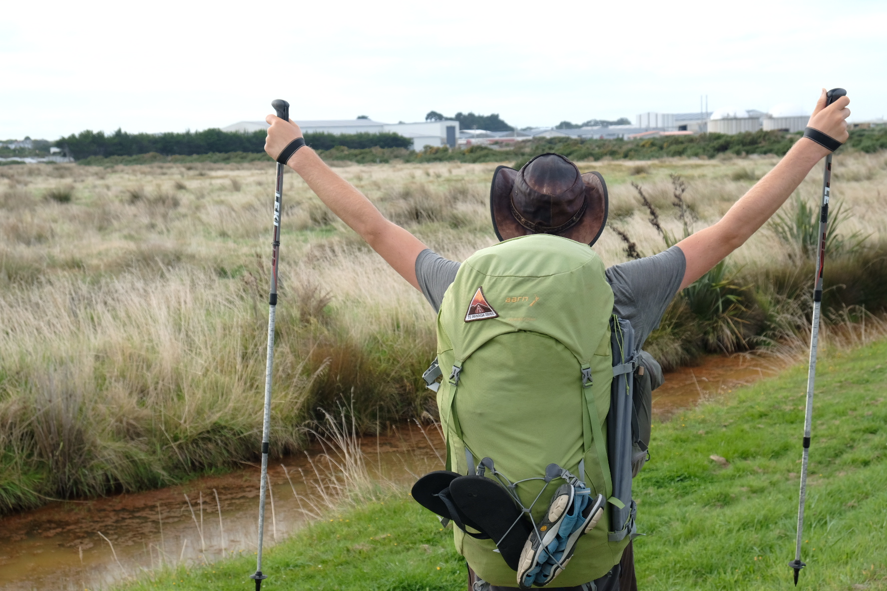
Considering that we had to hitch to get back on trail, we had rather slow start in the morning. The reason: it was Yerin’s birthday! She was now 18 and could legally buy whisky, which she immediately set out to do. Now she could finally taste this liquid that we and Brianne had been drinking. After this historic moment, we still had to resupply (and buy our own whisky), and after that it was lunchtime so we hung around Te Anau for a bit longer. Then it took forever to get a ride, so it was mid-afternoon when we finally started walking. We knew Yerin was ahead somewhere, as were Courtney, Emeric, Paul and Oli. The track to Lower Princhester hut was on a gravel road. There were some good views of the Takitimu ranges but we knew already that the TA wasn’t going to go over any of the interesting-looking peaks that we could see. Just beyond the hut was a DoC sign that we hoped was overly pessimistic. It suggested it would take us three days to reach the start of Mt Linton station (a massive farm that we’d have to cross). Three days! We were hoping to reach it the next afternoon - a day and a bit! We climbed steadily through the forest until we reached a saddle. From there it was a gradual descent, sometimes through forest, sometimes through tussock lands. The trail was well-marked. In the forested sections there seemed to be an orange triangle on every other tree, sometimes more than one per tree! The tussocks had more marker poles than we had ever seen before. We speculated that each region in NZ receives the same number of markers from DoC regardless of size. This would leave the markers thinly distributed in Canterbury, but not in the much smaller Southland. As dusk began to fall, we realised we weren’t going to make Aparima hut, so we camped by a small stream on a relatively tussock-free patch of ground.


Wonder if there are enough markers here

Golden hour in tussockland
It was clear that autumn was approaching. The days are getting shorter and shorter. We used to be able to get up at six, in daylight, and continue hiking (or at least sitting outside) until nine in the evening. But now it was still dark outside when we got up, and we had sometimes had to push a bit to ensure we were at the hut or campsite before sunset so that we still had some light to make camp. In addition, the nights were getting chilly and this night was no exception. We breakfasted and packed up our tent in the cold darkness, and set off just as the sunlight began creeping down the distant mountains. The tussocks were dripping with dew and we were soon soaked from pushing through them. Any part of us that was still dry was soon taken care of by the boggy ground. We reached Aparima hut in time for a snack break. Yerin was already gone, but Courtney, Emeric, Oli and Paul were still hanging about doing nothing much. This annoyed me to no end, which I know is very unreasonable of me. They were taking their time, because it wasn’t a very long day for them (they were starting from the hut), and they are fast even on ankle-twisting boggy tussock terrain. But my feet were already painful, with sore spots under each heel, even though we’d done less than 10 km. We had more than 20 km to go and I was starting to wonder if I could do it. Hearing others chatting about the coming trail as if it was a bit of a joke was no fun. There are probably a few TA trampers out there who feel exactly the same about my love for scree slopes, rocky scrambles and steep forests where you have to pull yourself up by your hands.

Cold mornings

My despair lifted a bit as we continued and left the bog behind us. The trail through the beautiful Takitimu beech forest was not nearly as bad as the trailnotes made it out to be. It had warned us that trail was light or non-existent, so we feared the worst. It was actually a pretty normal trail. Not as broad as the Greenstone track or the Timber trail, but not nearly as overgrown as Raetea forest either. We began to feel like we would make it to the campsite before dark. There were plenty of little ups and downs which became wearying after a while, because it seemed we weren’t really going anywhere. Courtney and the three French guys overtook us in no time, as we knew they would. We kept up a fast pace (for us anyway), so we made it to the Lower Wairaki hut in time for a late lunch. But not before getting our damp boots soaking wet in a river crossing just before the hut. Courtney and co were still at the hut, taking their time over lunch just as they had done over breakfast. We hastily dropped our packs and began to eat our lunch wraps as quickly as we could. We had half an hour, perhaps an hour, to eat and rest. And to filter some extra water. At the very latest, we had to be walking again by four o’clock, which would give us about 4 hours of daylight to reach Telford burn campsite. The sign outside the hut said 8 hours, but we were beginning to realise that the DoC signs on this section were perhaps a little bit off.

Scenic forests
We need not have worried. The last part consisted of a climb, actually the last time we would go above 1000 m on the TA. Jakub and Katerina had told us there were good views to be had from the summit and that it was a good climb, and they were of course completely right. The gradient was perfect. We could keep up a steady pace while rapidly gaining altitude. Best of all: towards the end of the climb I glimpsed someone just ahead of me between the trees. We were overtaking one of the other four, even though they had left a good twenty minutes before us. Climbing is what we’ve always been best at, and damn did it feel great to be so good at it that we could catch up with one of the fast people despite their enormous head start. As it turned out, we didn’t actually overtake anyone because just then we were distracted by the sight of a small owl sitting on a branch just beside us. A morepork! They are tiny little native owls that we had heard pretty much everywhere (they basically say “morepork” so are easy to recognise), but this was the first time we’d seen one. We hung around watching it, and it watched us back, turning its head nearly upside down. This was without a doubt a Good Climb. Finally we tore ourselves away and climbed the last fifty metres before emerging onto the open top to take in the glorious view. There were clouds above us, below us and all around us. Visibility was about ten or twenty metres. Nevertheless we hopped about excitedly and stared south-south-east, towards Bluff. Oli was compelled to point out to everyone that it was possible to see Bluff from this point on a clear day.
Because we were now on a mountain top we had reception, and at some point everyone got their phones out to check weather updates and send messages home. It didn’t take long until we found out about the horrific attacks in Christchurch. It felt unreal that something like that could happen in New Zealand, the same country that we had been walking through for four months. As if it must have happened somewhere else. Conversation was muted as, one by one, people set off down the ridge.
The fog meant that we could hardly see the marker poles, but from the map it was clear we were meant to stick to the top of the ridge. As the ridge began to go steeply down, Jasper slipped slightly but caught himself just in time. We went a little slower after that, but still got to the Telford Burn campsite in good time before sunset. Now we were in the perfect position to do the 25 km across Mt Linton station in one day - the only way to do it, because camping was absolutely not allowed there.

Morepork!


Dental floss repairs
Soggy feet pt 1

Soggy feet pt 2
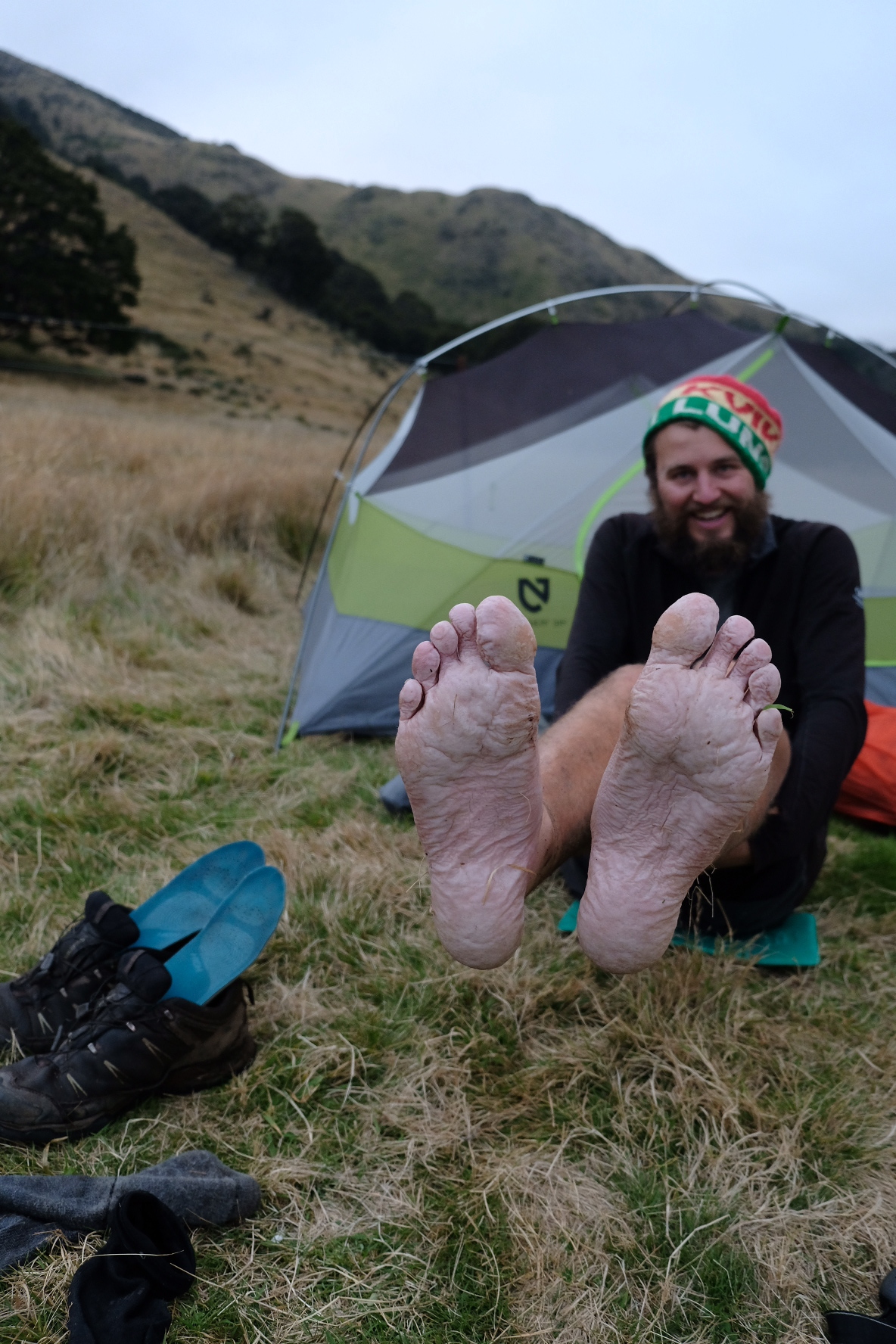
Courtney and her group had reached the campsite ahead of us and were gathering wood for a campfire. Yerin was there too (hurray!), as were Wieke, Dan, Liv and a Kiwi guy called Ron. We dropped our packs, pitched our tent, aired out our wrinkly wet feet, and then Jasper discovered that his pack was falling apart. The suspension was breaking! Aarn packs have interchangeable rather than sewn-in hipbelts; they are velcroed into a sleeve on the back of the pack, and that sleeve is attached to the pack itself via a thick sewn strap. Not thick enough though - the stitches were all but torn. Even worse, when he bent down to get some water from the stream he felt a sudden pain in his back. He must’ve pulled a muscle slightly when he slipped on the descent, and aggravated it when he bent down. We patched up his backpack with a spare strap and some dental floss, and hoped that a good night’s sleep would cure his back overnight. Then we patched up my pack which was having issues of its own. The bent outer frame was putting too much pressure on the central rod. This central rod connects to the frame at the top (via a little metal toggle thing) but at the bottom it doesn’t. It just sits in a little sewn-in fabric sleeve. That had torn with the result that the central rod wasn’t contributing anything towards structural integrity anymore but kept slipping out of position and poking me in the neck. A whole lot of leukoplast from our first aid kit soon fixed that, but for how long? These packs needed some serious repair work, that was clear. With our basic repair work over, we gathered around the campfire with the others to cook. Entertainment was provided by Oli, who drank most of Yerin’s birthday whisky and got louder and weirder until Wieke took pity on him and helped him make dinner.
We learned that sleep will not magically cure a pulled muscle. Jasper was still in pain the next morning. Carrying a pack with half-broken suspension did not seem like a good idea, but we didn’t really have any alternatives. Sure, we could have hung around the campsite for a day but we didn’t want to. So I took as much of Jasper’s gear as I could to lighten his load, and prayed to the TA gods that my feet would have a good day. As usual we were the first to leave in the morning. The trail across Mt Linton station was not extremely long or difficult, but because it is on private land there are certain rules and conditions that must be strictly adhered to. No camping. No access between sunset and sunrise. Absolutely no going off the marked trail. Plus the usual: leave gates as you find them, don’t bother the livestock (honest, I won’t bother the cows if the stupid animals will only leave me alone!), all straightforward common sense stuff. The people at Mt Linton had some trouble with a TA hiker breaking into a private hut back in 2017 or so, and since then they’ve understandably become a bit more reluctant about allowing access and a bit more aggressive about the rules. Once sign warned us that veering off the route would result in us being prosecuted for trespassing, which carries a prison sentence. Such a cheerful start to the day! So here we were, two walking wounded with broken backpacks, trying to get across a farm in a day to avoid going to prison. Not what we were expecting when we set off from Cape Reinga.

Just a friendly warning

Jasper could walk, just about, and my feet were doing ok once my muscles had warmed up. My socks and boots had dried out a little bit overnight, and I had ten minutes to feel pleased about this before we had to ford a river. Next we jumped a boggy ditch and I almost fell backwards into it because I was a bit backheavy from taking so much of Jasper’s stuff. A grassy 4wd track provided easy but slightly dull walking, but luckily the scenery made up for that. There were narrow valleys and brooding mountains, and only a few fences showed that we were actually on farmland. The cows were nowhere in sight. The sun was coming out and we took a snack break while we dried out our tent. I optimistically put my socks and boots out to dry too. Jasper’s back was improving very slightly, and we ate enough snacks from my pack that I could take a further small heavy item from him (the whisky bottle). Perhaps Mt Linton wouldn’t be so bad, we thought as we set off again. The track was undulating but even, and easy to follow, we thought, as we walked right past an almost invisible path that veered sharply down towards the river. Luckily I happened to glance back a minute later and saw a marker pole down in the valley. Whoops. We backtracked and took the narrow path. Every single person I spoke to on the TA missed that turn.
We had to cross the river in the valley, which meant my boots once again became sopping wet. I don’t know why I still bother to try to dry them out at every break. I comforted myself with the thought that at least it was clean water. You can probably guess what was beyond the river: a kneedeep bog that we had to splash through. And then it was back to 4wd tracks. The first sheep made their appearance too. A few sad-looking marker poles were attached to the fence, the orange colour nearly bleached away by the sun. This was confusing. Were we meant to follow the fenceline, or were we allowed to walk on the 4wd track that ran parallel to it thirty metres away? We did a bit of both, and played a few rounds of “spot the marker pole”. For people who didn’t want us to go off trail, the Mt Linton farmers sure had put up a surprisingly small number of poles. There was one that you couldn’t see until you had already gone around a corner, one that was placed beyond the crest of a hill, and one that was huddled in the shadow of a massive fir tree and practically invisible. Then we reached a surprisingly easy bit, with an even track that followed a contour line across a sloping turnip field. And this is were we got our first view of the sea!

I see the sea!
Just as we were beginning to think it would be easy from now on, the turnip track ended and we were dumped in a field that had a bunch of vicious-looking bulls right in the middle of the lumpy track. Damn and blast! We sidled around the beasts and had lunch as far away from them as we could manage. Jasper’s back was slowly improving, and my feet were slowly deteriorating. We walked on trampled, lumpy fields for most of the afternoon. The only positive thing was that most of the fields had sheep rather than bulls. Navigation became trickier. In addition to a distinct lack of poles, we now also had a lack of navigational aids. Our map and gps said the trail went one way, but the poles said something else, and we knew we had to follow the poles. We only wished there were more of them so that we actually had something to follow. Somehow, we made it out and it was a relief to cross the bridge that marked the edge of Mt Linton station. No prison for us, haha! We trudged along the road to Birchwood station, which is adjacent to Mt Linton and whose owners have been savvy enough to realise TA hikers = additional income. They have an old shearer’s cottage with a big bunk room that you can stay in for a small fee, complete with kitchen and hot shower and a cold beer (for another slightly smaller fee). They also have the world’s longest driveway but we got there in the end.

View back over the station

The shearers hut
The bunk room filled up nicely with everyone from last night’s campsite, plus Myriam who had managed to get here just after us despite having done a cruise on Dusky sound before leaving Te Anau. She had a quick look at Jasper’s back and demonstrated her years of medical expertise: “Pulled muscle. You’ll live.” It was getting better, luckily. I did not want her or any other doctor looking at my feet because I knew full well what the medical advice would be: rest. This is not something I wanted to hear when less than 200 km from Bluff. Hell, no! Jasper and I had agreed that for our packs, my feet and his back it was Bluff or Bust. Or possibly both.
We spent an enjoyable night at the Birchwood cabin with Ron, an experienced Kiwi tramper. Together we plotted a Te Araroa High Route that would take you from Ohau to the South Coast. What a trip that would be! From Ohau, you would go up to Brodrick Pass and then down the Landsborough valley. From there, a little bit of roadwalking over Haast pass before going into the Young valley, over Gillespie pass, up the Wilkin valley, over Rabbit pass and down the East Matukituki valley. From there we had already done a bit: up the West Matukituki valley and over Cascade saddle! But the high route didn’t stop there: halfway down the Rees valley you would cross Lennox pass into the Earnslaw burn valley, and follow that down to link up with the Routeburn track. Then it was back onto the regular TA down the Mavora walkway. But from Te Anau our High Route would take us along the Dusky trail and then finally down the old Humpridge trail (to avoid paying 100 dollars for oats) to the South Coast. The three of us considered the map happily. It would take extended periods of settled weather, perhaps a support team to bring food, and a love of wet feet and wading through mud. Ron had already walked large chunks of this High Route and had great stories to tell.
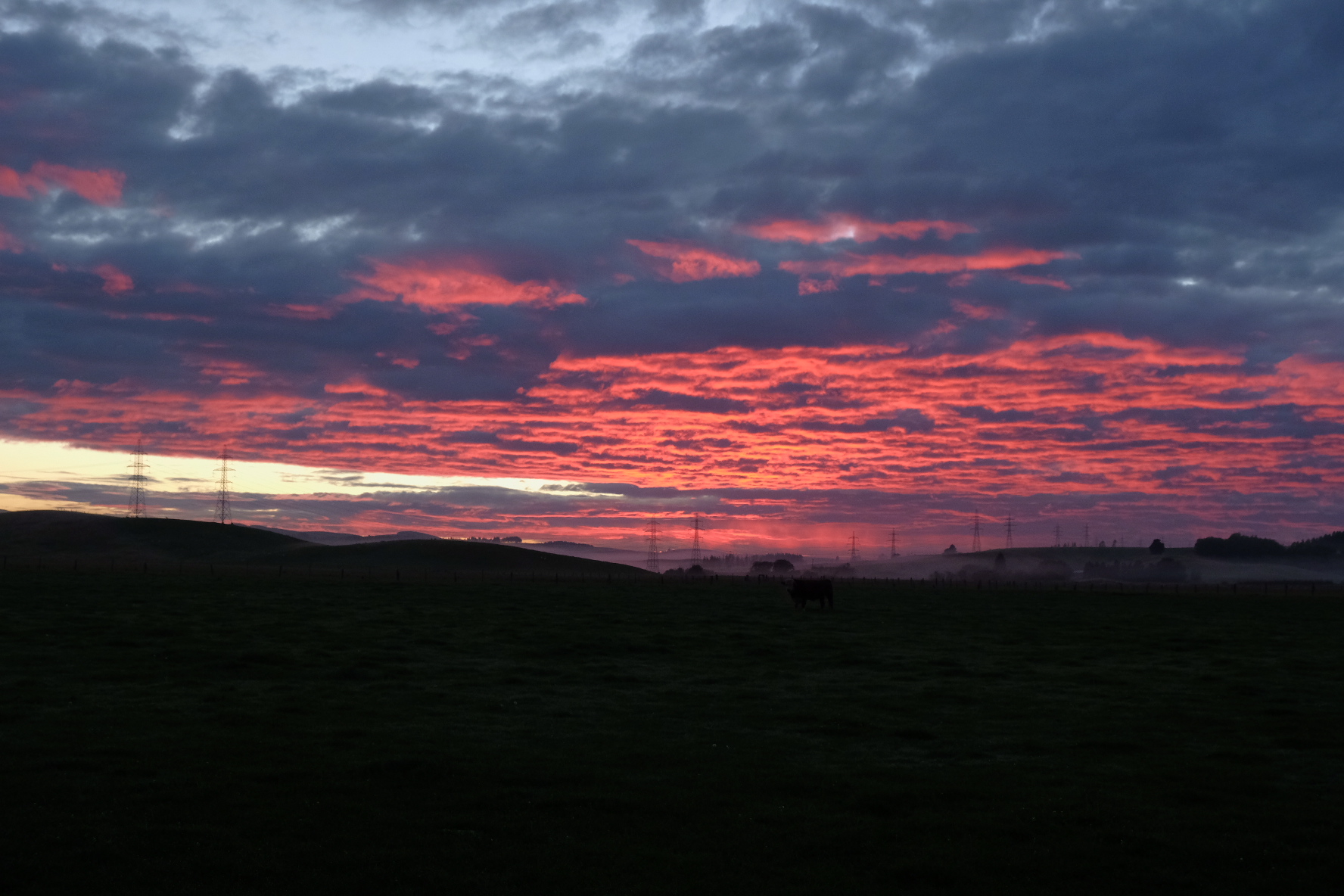
Red dawn at the station
Staring
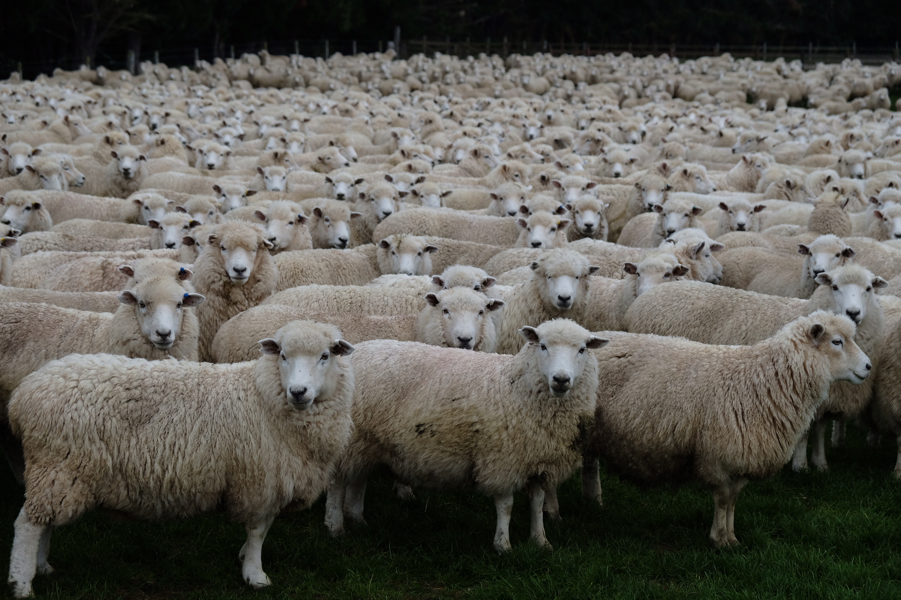
There was no High Route for us the next day. We set off early with Yerin to do a bit of roadwalking, a bit of tramping on farm tracks, and some on forestry roads. It was like being back at the start of the TA. Luckily we didn’t have to walk the Birchwood driveway back because they said we could continue down it and join up with the road on the other side, thus saving us a good half hour of backtracking. It seemed to be sheep shearing season, because they had rounded up more sheep than I have ever seen in my life and put them all together in one field. The sheep all watched us as we strolled past. Next we got a demonstration of the wonders of modern technology, as we passed a patch of forest where they were logging. There was one big machine that would pick up entire trees and in less than a minute strip it of bark and branches and cut it into neat pieces. We watched it for a while, mesmerised, and then continued climbing up the field next to it. The climb was unexpectedly steep but we were rewarded with a good view from the top. Yerin continued walking because she had to do some hitchhiking that afternoon to buy new food. Jasper and I had done a big resupply in Te Anau so took a snack break instead. As we set off again, on gravel roads through pine plantations, we began to hear ominous tearing sounds from my pack. Some velcro around the hipbelt was loosening and it took forever to tuck everything back into place. Then Jasper’s improvised repairs of his suspension system began to give way. Myriam walked by as we were standing by the side of the road, bits of Aarn pack scattered about. She has one too, but hers is still in pristine condition. Perhaps because she doesn’t cram as much into it (we have discovered the joy of snacking to a far greater extent than some of our friends). She did have a handful of cable wraps that she had carried since Cape Reinga, and was happy to lighten her pack by a further ten grams so that Jasper could temporarily attach his suspension system to the frame with something sturdier than dental floss. It worked pretty well, and with his back feeling better with every step we were ready to go again. We decided we were going to try to keep up with Myriam, plus Courtney, Emeric, Oli and Paul, who appeared just then. These people are fast, but we managed for about 4 km until a new type of stabbing pain in my left arch told me to slow down unless I wanted it to be Bust without Bluff.

Southland... It’s like Northland, but south!
So we slowed down and lost sight of the others as we descended through beech forest. We emerged on a gravel road and were slightly surprised when we checked the map that the low hills in front of us were the infamous Longwoods, the last forested hilly section on the TA. After a quick lunch we continued walking through Island Bush. On the map it looked like it was a weird “trying too hard” track through a tiny patch of forest just to get the TA on trail and off the roads. But it was actually surprisingly nice. It wasn’t native forest, but the pine trees were old and gnarly and there were bright red mushrooms growing everywhere. Unfortunately it did end with a small field of cows but at least they didn’t chase us. We emerged onto the main road, where we already spotted several groups of TA hikers trying to hitchhike into Otautau to resupply. We still had plenty of food so walked to Merrivale instead. It was not a fun road to walk on. There was only a narrow shoulder, the ditch sloped steeply, and there was an uncomfortable number of trucks. Merrivale is a little hamlet and has a cute little hut for TA hikers. We got there a little after four o’clock and decided we might as well walk further to try to make the next days a bit shorter. Yerin hitched in from Otautau just then, her pack full of snacks, and joined us. We walked most of the gravel road until the Longwood trailhead, and then pitched our tents on a flattish bit of land that we found. The grass there was of the type that gives you papercuts, so there was a lot of swearing as we pitched our tents and prepared ourselves for an early start the next morning.

Shrooms
We packed up the tent in the dark, after a quick breakfast of oat bars (better than oat porridge but not by much). Yerin managed to get a few more papercuts from the grass. Then it was time to enter the notorious Longwood forest. Until now, the South Island TA had been virtually mud free. Every time we had happily pointed this out to NOBOs they had shaken their heads and muttered “Wait until you see the Longwoods!” At those times, with still hundreds if not a thousand km to go until Bluff, we had laughed about this. If the only mud to speak of was right at the southernmost end of the island, then the rest must be mud free indeed! And now we would see how bad it really was! To sum it up: it wasn’t bad at all! I suppose heavy rain might make it a bit trickier but this was way better than we had expected. We started with a good climb on a track that was a bit soft, but the mud never reached above the ankle. I started climbing happily, glad to be back on terrain that I could do easily and quickly. The path was quite wide and the treeroots made for easy climbing. Plenty of orange triangles showed us the way. Just before the summit we found one patch of mud that was deep. We followed our old Raetea forest strategy of jumping right in to get it over with. I sank down to halfway up my knees and then realised my left foot was stuck. On the other side of the mud pool was a steep bank and I had some trouble getting up it. Eventually, with some help from Jasper, I pulled my foot free and realised immediately I must have wrenched it in a way my plantar fasciitis did not like. It hurt! I treated the mud with a bit more caution after that - my foot could not have another twist like that. For the rest of the day I tested the mud in front of me with my trekking pole and once or twice took a small detour or jumped over some of the deeper bits. However, I was resolved that if we came across a patch on the trail that was deeper than Pirongia (mid thigh), then I would go in and plantar fasciitis be damned. It would be fun to have an even more extreme maximum mud level. No such luck. That one deepish patch was the deepest of the Longwoods trail.

Yerin navigates a mud patch
We emerged onto the open top of the aptly named Bald Hill. But once again Bluff was hidden from view by clouds. This time they were just below us, a glorious inversion, while we were basking in sunlight. We followed a gravel road from the transmission tower along the hill and down. There was one interesting climb where a massive padlocked gate barred our way and we had to go around. Then the road ended, and we had another climb through the “muddy” forest to reach the open tops and ridge of the Longwood range. The sea of clouds still stretched out below us and we had an enjoyable lunch break, at least until we realised we had reception and the latest news reached us. There had been a shooting, in Utrecht of all places! We took some time to sift through our messages, and to our relief none of our friends were involved in it. It still left us with a weird feeling. First Christchurch, now Utrecht!

We can see the sea of clouds
It was just a short descent to Martin’s hut. But the trailnotes estimated 9 hours for the section from the roadend to the hut. If that was true, it would take us 4 hours to walk 4 km. Would it be as muddy as Pirongia, or as overgrown as Raetea, or both? No, we were just a lot faster than the trailnotes (which felt pretty good to be honest), and followed the reasonably muddy and sometimes steep trail down in less than two hours. The trail improved as we descended and each time it became noticeable better we speculated wildly how bad the rest would be to make it take 4 hours, and were a little bit surprised when we bumped into the hut.

Probably the biggest bog near Martin’s hut

Honestly not that muddy
Martin's hut is the last hut on the TA. Instead of a normal hutbook it has a book where TA trampers leave sentimental messages to their friends behind them and write other vaguely inspirational stuff. We scribbled something down for Brianne, Courtney and Sarah, took a few photos, and continued walking. The muddy track quickly gave way to a gravel road, which we followed for a while before turning into Ports Water Race track which winds it way through regenerating podocarp forest, with the occasional forest giant still standing. The track follows the water race that was constructed more than a hundred years ago to provide water for mining. It slopes very gradually and evenly. To do this it twists and turns. The trail had apparently been maintained and upgraded recently. In places it was smooth and neat, but every so often there would be a massive obstacle. A fallen tree. A slip that had taken a chunk out of the path. On either side of the path were deep ditches so that we could not easily go around any of these obstacles. Instead we had to spend a lot of time clambering over trees and jumping over gullies. I had the usual pain in my heels and arches, and this was now combined with pain from developing blisters. A tiny tiny thorn or grain of sand or piece of twig must have worked its way into my sock somehow and was rubbing the side of my foot raw. Our feet were wrinkly and swollen, having been in wet boots since before Te Anau, and we were getting blisters between the wrinkles. Damn my boots. The stupid things become more uncomfortable the wetter they get. It was a relief when we reached a small clearing with some old mining machinery. This would be our camp spot for the night. We pitched our tents, trying to leave some room between our massive Palace and Yerin’s somewhat smaller one person tent. Just in case someone else showed up late. Yerin could not be bothered to go back a few minutes to the stream to wash, but Jasper and I strolled back. A wave of nostalgia for the North Island washed over us as we sat side by side, rinsing muddy socks and shoes in the stream. After our sock cleaning session we could not be bothered to cook any dinner. We sat in the darkening gloom amidst old mining machinery, eating all our snacks. It had been a good day on the TA - nice forests, mud, a stream to wash in, and now an epic snack binge with Yerin. Crackers, cheese, peanuts, lollies and many other edibles were passed around and shared until we were left with a pile of empty ziplock bags.

Gloomy bush

Camping with old iron
We had only done a small part of the water race track, and the next day we were once again winding our way through the forest. The number of obstacles seemed to only increase. One fallen tree in particular gave us grief. It lay straight across the path, with a trunk almost as wide as I was tall. There was no way I could scramble over that. The gap under it was too small to crawl through. On the right was a muddy ditch that looked suspiciously deep, and with steep sides that would make for a difficult, slippery scramble. To the left of the path the tree’s branches extended over and down to the other ditch, forming a muddy tangle that looked like a network of security lasers from a Hollywood movie. We stopped to consider this obstacle for a while. Should we go muddy right, or tricky left? Yerin opted for left, which involved a slide down a muddy branch and then a scramble to get through and over. I went left too, sliding down the same branch and then picking my own scrambly way through the rest of the branches. Jasper did what he always does: he stepped right across this Mount Everest of trees in three steps.

Navigating a tricky section of the water race
After an entire morning on the water race track we were getting a little bit fed up. So when we saw a signpost indicating we were at the McKay exit, we took it. This would take us on a little trail across the McKay farm and then join up with the road, bypassing the last 5 km of the Longwoods and a similar amount of roadwalking. At the junction, we met some of the McKays themselves, who were out for a walk with assorted grandkids and young cousins. We got chatting to them, and then they invited us over for tea and TimTams which we never say no to. They had a lovely view from their farm. The sea was so close we could smell it! So after a third cuppa we said our goodbyes and walked the short distance into Colac Bay, where the tavern had turned into a sort of TA headquarters. Myriam, Paul and Oli had been there since the previous evening and were eating their way through the menu to celebrate Oli’s birthday. Courtney, Emeric, Wieke, Dan and Liv showed up a bit afterwards. Most of the outside deck was taken up by packs, boots and muddy socks, while inside it was heaving with TA hikers and the biggest table was covered in plates. Every time someone ordered food, the arrival of the dish was greeted by loud “ooooh”s and “aaaaah”s. Then at least two others decided that it looked really delicious and decided to order the same. This went on for a while. After all, it was only 10 km to Riverton, where everybody was planning to stay that night. And some of it was beach walking which we wanted to do in the late afternoon because of the tide. So we hung around, eating.

A small fortune of tramping gear

Close!
Jasper, Yerin and I left relatively early because we wanted to give my feet enough time. After a short walk down the street we arrived at the beach. It was the first time we’d been at the sea since leaving Havelock, some 1200 km ago. And the first beach we would walk on since the North Island. We whooped and laughed and ran around like idiots, shrieking with joy when we realised we could see Bluff in the distance. Then we walked along the beach, which a short one. The sand gave way to pebbles, and we stopped to have a chat with Nathan, an American hiker who goes by the unfortunate trail name of G-string. The origin of this name had something to do with a guitar he carried on the Pacific Crest Trail and was not related to his minimalist approach to underwear. Nathan was going to find a spot to camp, while we carried on. After the beach we reached the last bit of farmland on the TA! We scrambled up some headlands, and found ourselves in some fields with sheep and not that many marker poles. We took a wrong turning somewhere, ending up in a field surrounded with fences that were 2 m high and impossible to climb. It took a bit of backtracking before we were back on trail. We have become quite good at playing “spot the marker pole”, and we invite you, dear reader, to have a go at the photo below. After the farmland there was a nice section through bush, one of the last remaining coastal podocarp forests in NZ. A short climb led to a lookout and I decided to climb this as fast as I could, which is very fast indeed. Jasper and Yerin then did the descent as fast as they could (which is also very fast indeed) so that they could buy some food at the supermarket before it closed.
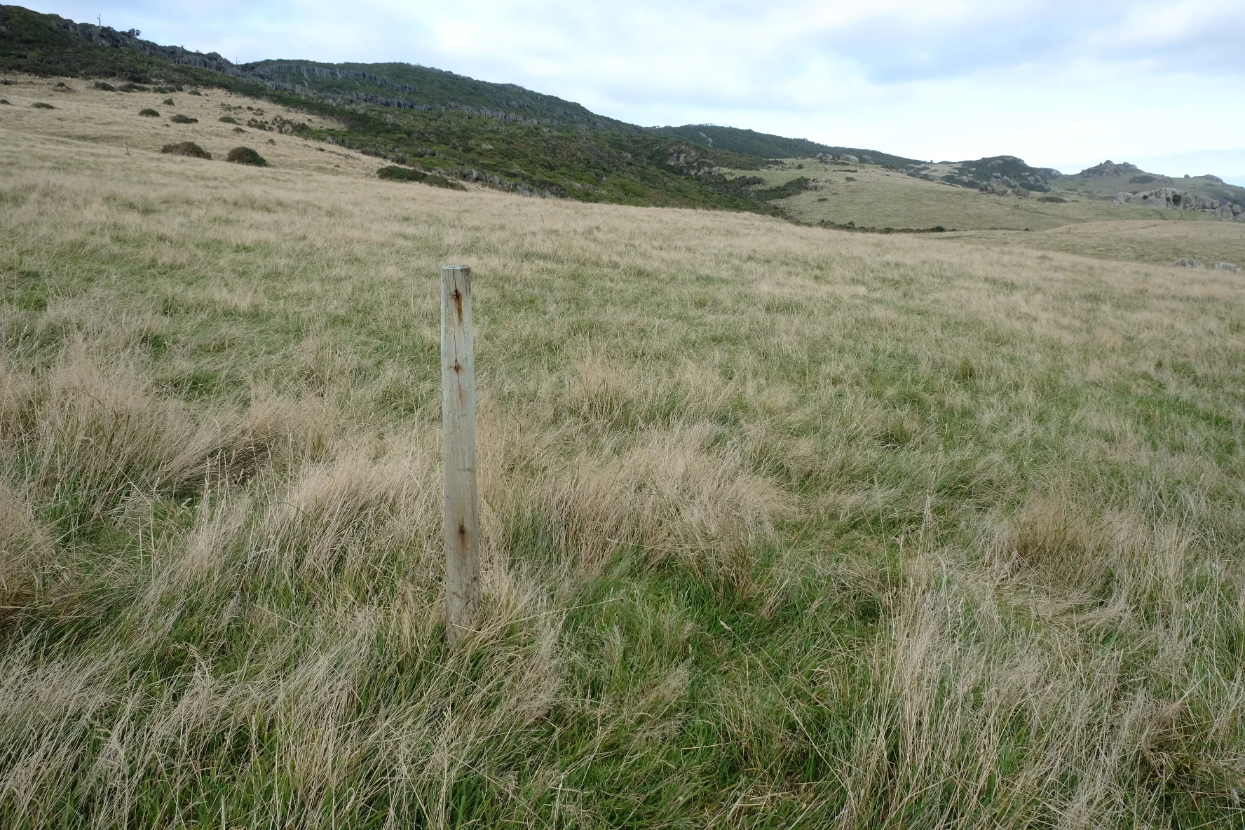
In this picture there are two marker poles. None of them can be seen, however, we consider this beginner level

Gnarly wood
It was getting dark when we reached Riverton holiday park. The others from Colac Bay arrived not long after us, and yet other TA hikers had gotten there before us, so that we could not move without bumping into old friends and acquaintances. Ralph, Laine and Iben were there! And Marion and Francois! We had thought they were a day ahead of us, and so they had been until disaster struck! A pair of crutches was leaning against the wall behind Francois... The poor sod had gotten a small wound on his foot somewhere on Mt Linton, and this had gotten horribly infected in the Longwoods until he was so feverish he could barely stand. They had rushed to the doctor in Riverton, who had cleaned the wound and pumped Francois full of antibiotics. He had to keep coming back for new shots, so until this infection finally went away completely they had to stay in Riverton.
From Riverton to Bluff is about 70 km. Many of the people in the bubble were going to do it in one final 24 hour march: Courtney, Myriam, Emeric, Paul, Oli, Wieke. The first part was on the beach which is easiest at low tide. This meant walking it early in the morning or late in the afternoon. The 24 h marchers opted for late afternoon, so they had a lazy morning ahead of them and accordingly spent most the evening drinking and chatting. Jasper, Yerin and I decided we would do early morning. If we started 12 hours before the crazy gang, we could do the last 70 km in two normal days and still get to Bluff around the same time. Dan, Liv, Ralph, Laine and Iben were planning two normal days too. If all went well, we would finish at the same time as just about everyone we had walked with on the TA! Except Marion and Francois of course. And Brianne. And Sarah. So not quite everyone, but at least many many people.
By “early morning” I mean “in the middle of the bloody night”. We made it to bed just before midnight and were up again by 3 am. Months ago, we had done something similar on Ninety Mile Beach. Back then we had walked under the stars and been treated to a spectacular sunrise. We looked forward to having another experience like that, and so of course it was foggy. The three of us trudged through the eerie, deserted streets of Riverton. In the dark, we missed the apparently obvious track to the beach and instead ended up in a paddock. We jumped one fence easily. But missed the second one. I walked straight into some barbed wire. Not fun at the best of times, but in the middle of a dark and foggy night it’s even grimmer. We found our way around it somehow and then were relieved to feel sand under our feet. A quick check that we were going the right way, and then we were off! Walking at night on Ninety Mile Beach under the stars was strangely mesmerising. Walking at night in the fog on this one, North Beach, was just strange. We could vaguely make out the shape of the dunes on our left, and barely glimpse the sea on our right. But ahead was just a big empty nothingness. As if someone had cut a whole out of the world. My brain did its best to fill it with images, and I had to keep shaking my head to avoid seeing a city on a high hill. There were no hills in front of us, and it was too foggy to make out any lights that could be Invercargill. Our beach walking skills from the North Island had not deserted us, so we made good time and the weirdness of it all did not stop us from walking. I sang some of those nonsense never-ending counting songs under my breath, occasionally we belted out a Disney song or two, and gradually we began to notice that is was becoming lighter. As the world around us turned grey, we splashed suddenly up to our ankles through water. A stream! We knew there was a stream on this beach, but surely we couldn’t be there yet? We were. Around sunrise (not in any way spectacular) we stopped for breakfast and saw we had already done 17 km. Hurray!

Beaches
Another hour or so found us at the end of the beach, where we flung down our packs and spent some time eating snacks. I took of my wet, sandy, horrible boots for what I sincerely hoped would be the last time. The sand and the salt water had turned the soles of my feet a weird reddish purple. I put my trailrunners and dry socks on, and as we did the long boring road walk into Invercargill, I kept talking about how nice it was to have dry feet. Jasper and Yerin, who did not have the luxury of dry shoes, did not seem to enjoy this as much as I did. Invercargill has been described to us as a city with nothing to do, but great if you’re passing through and need to do some shopping. It also has pretty good food. We arrived there around noon and spent the entire afternoon flopped down in a cafe where we ordered endless cups of coffee and a steady stream of cakes. Then Yerin went off to stay with a trail angel and we went to our B&B to sleep, and to mentally prepare ourselves for the last day on the TA.

How to survive the last day on the TA

Bluff!

Pong!

Old friends!

Active hitchhiking strategy
We felt strange when we left Invercargill the next morning, for our very last day of hiking. How could the TA end? How was it possible that this massive 3000 km adventure could ever come to an end? Yerin was staying somewhere else in Invercargill, so it was just the two of us, walking out of Invercargill in the morning. We followed a gravel walking/cycling path along the estuary. It was lined with cabbage trees and flax, the plants that had been our constant companions since Cape Reinga. Ahead of us was a peninsula: Bluff. So close! After perhaps an hour on the estuary walkway, we left the birds, the cabbage trees and the flax behind. A sign informed us that we were now approaching the sewage treatment plant and that we might “experience odours”. Not the most inspiring ending to a once-in-a-lifetime epic hike. Luckily we had whisky. Or perhaps paint stripper would be a more accurate description of the amber liquid in that bottle. It was not exactly quality stuff, but that’s fine, because drinking good whisky at ten in the morning when walking past a sewage treatment plant is a waste. Next up on the list of glorious sights on the final day was a mountain of what we first thought was gravel, but on closer inspection turned out to be oyster shells. We took a final snack break, and then waited a bit longer so three hikers we spotted on the path could catch up with us. It was Ralph, Laine and Iben! We passed the whisky bottle around and told riddles while we walked. Iben still hasn’t discovered the pattern behind “Magic Spoon” but we felt it would be a bit mean to her to play that on the final day. We said goodbye to them at the fertiliser works, where the walkway joined with State Highway 1. They would continue walking, while we were going to hitch one final time. Yeah, the TA has got a 15ish km section on State Highway 1 on its final day. The road is reasonably wide but full of trucks, and we didn’t want to be hit by a truck and die with Bluff in sight. So hitching it was! We got a ride from a bunch of kiwis who were going to Stewart Island as a family reunion holiday. They were happy to drop us off at Stirling Point, the official terminus of the TA, but we decided not to take them up. Bluff itself would be fine.
We hung around in Bluff, polishing off our snacks and whisky, as we waited for the rest. We wanted to walk the last bit with the 24 h marchers and Yerin, who had joined up with them. Needless to say, these weirdos were all going to do the roadwalk, so we had a few hours to kill. We met Valeria, who had gotten here a few days earlier after some crazy final day, and Fabrice, who had indeed walked 100 km in one go and was still recovering. But the prize for best arrival in Bluff goes to Eric and Emma: they had done a long final day too, and ended up doing the State Highway 1 part at night. Despite head torches and high vis vests, some drivers had apparently complained about the danger, and the result was that they were picked up by the police, who then dropped them off at Stirling Point after some stern words about the silliness of road walking at night.
Inspirational isn’t it?
Ralph, Laine and Iben arrived in town a few hours later, and together we bought a very fancy bottle of whisky to celebrate at Stirling Point. We had made vague arrangements with Yerin to climb to the top of Bluff hill together (because the path around it was closed). But the road walk took longer than they thought, so now they were planning to go directly to Stirling Point. Damn! We wanted to go to that hill! We grabbed our packs and hurried off, a little bit behind Ralph, Laine and Iben. It was a surprisingly steep final climb, but the views were pretty spectacular. According to our maps, there should be a path leading from the summit directly to Stirling Point. If we took that, we might still arrive at Stirling Point together with the rest. No such luck. Ahead of us, we saw Ralph, Laine and Iben fighting their way back out of some gorse bushes that grew where the map said the path was. So the five of us ended up taking an expert level mountain bike track down to Bluff, and then walked along the road to Stirling Point.

From the Bluff


The state of the final Kvikk Lunsj after 3000 km
Stirling Point is a bit shit. It’s not the southernmost point of NZ (even if you ignore Stewart Island). It’s a parking lot at the end of State Highway 1, with one of those signposts that point to random faraway places. But it is the end of the TA! All the 24 h marchers plus Yerin were already there and, by the looks of it, already well beyond slightly tipsy. They had giant medals that you could get for free from the nearby Oyster Cove restaurant and were screaming themselves hoarse while clambering over the sign. The five of us hurried over to get our medals (apologies to all hikers who came after us: we literally got the last free ones), and then joined in the celebrations. We cheered as Dan and Liv came walking down the road. We took selfies with random Japanese tourists. I had a last bag of spinach. The fancy whisky was delicious and inspired us to take some good finishing photos. My plantar fasciitis would not let me jump up to hang from the signpost so Jasper had to give me a leg up. I also managed to give away my last bag of oats to a Dutch bloke called Koen. He said he liked them, but that may have been because he wanted me to shut up and stop asking everyone if they wanted oats. It’s all a bit hazy to be honest.

The anti-wekaweka squad minus two finishing
While Stirling Point is not the most inspiring place in NZ, it felt amazing to finish because we were with such a big group of people, all of whom we’d hiked with. We did miss Brianne (finished four days after us), Sarah (finished about two weeks later), and of course Francois and Marion. He hitched and she walked, and we gave them around of applause when they arrived in Bluff the next day, still with crutches.
To all our fellow trampers, our trail friends: thank you, we love you to bits!
And... now what do we do?

Marvel at this one