Te Araroa part 4: Déjà vu
A short summary of this section of the TA: departure from Waipu Cove (clean, and full of food), followed by a long day on the beach, a muddy forest with good food at the end of it, some alternative ways to wash, a bit of roadwalking, and finally a town with food. Remind you of anything? It was like doing a mini-TA...
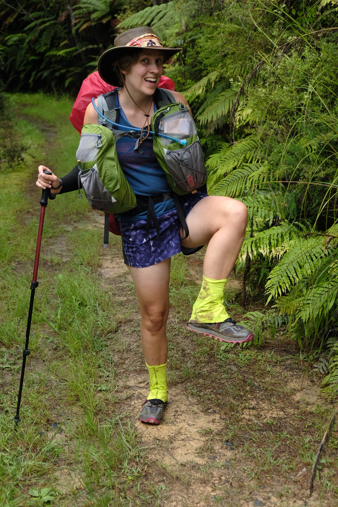
High fashion
We left Waipu Cove feeling a bit stiff after the previous day’s powerwalking on the beach in the rain. Slow but steady works as well and we made good time on the forestry roads. The weather didn’t really know what it wanted so it was on and off with raincoats for most of the morning. There were some great views from the Brynderwyn ranges (and also some sticky mud). For the first time in quite a while I didn’t get any stones in my shoes because I was wearing my new gaiters! Jasper had bought trailrunning gaiters before starting the TA but I couldn’t find any in my size. Instead I brought my old pair which are for use with boots. The elastic at the bottom was too tight when pulled down onto the opening of my trailrunners and I think this was partially responsible for my foot issues on Ninety Mile Beach. I hardly wore them after that, and I was very glad to leave them behind at John & Lyn’s and order a decent pair online. There have been other outfit changes as well. I have outgrown my fancy pale pink shorts - or actually the opposite: they became too big. So now my legs were clad in the following: pink and grey trailrunners, fluorescent yellow gaiters, awkward tanlines, and tiny purple shorts. And on most days I accessorised this with mud. I’m not usually known for stylish attire, but I think this look will be all the rage in Europe next year.
Anyway, on that first day from Waipu Cove, we saw Sarah and Courtney up ahead but we didn’t catch up with them because we stopped for so many snackbreaks. There were some fields to traverse but luckily the cows were on the other side of the fence. We followed a classic NZ tramping trail which plunged straight down into a narrow valley and then went straight back up again on the other side. A bit further on we were pleasantly surprised by the fancy Mangawhai cliffs path which was broad, flat, and even, and had marvellous views of the coast with some gnarly pohutukawa trees. The sun had come out and the last bit was a pleasant stroll through town. Plenty of locals stopped to chat with us about the trail, and one woman even gave us heaps of suggestions for hiking food. One of the things we miss most after several days on trail is fresh food. We have a carrot per day and plenty of dehydrated peas and mushrooms, but that’s not crunchy delicious fresh. This woman suggested we could bring a small amount of beans or lentils or whatever, and try to sprout them in a water bottle. Genius! We’re definitely going to try that. There will be a blogpost about the Great Sprouting Experiment, keep an eye out for it!

Views along the Mangawhai cliffs path

Kiwi slang 101: a bach is anything between a coastal shack and a second home.
It wasn’t needed yet though, because Mangawhai has a shop so we could buy all sorts of delicious food. With our daypack overflowing, we left the shop and headed to our destination for the night: Courtney’s sister’s boyfriend’s family’s bach. True. They’d told Courtney where to pick up the key and that she was welcome to bring her friends. How cool is that? The bach had a pretty decent kitchen with a freezer so of course we bought ice cream for dessert. We thought about getting some drinks too but that wasn’t necessary because Courtney’s dad had driven up from Auckland with some bottles of wine and beer for us. After hearing us talking about food for the entire evening, he apologised for not bringing food instead. We had a snack binge at the bach that night, plus showers, beds, and all those kinds of luxuries.

Estuary crossing: Sarah in front, Iben immediately behind, and Marte in the back

Philip keeps dry

The size of New Zealand flax is unexpectedly large. FzbL for scale
The next morning was a trip down memory lane for Courtney. She spent many holidays here as a teenager and pointed out various sights to us, such as the bridge she used to jump off. We breakfasted on cakes from the bakery, then walked on towards the beach. This one wasn’t so long: just one day. Fghgfgmmdf. We first had to cross a stream - this is best done at low tide but we were there at high tide so the water was almost to my waist. Sadly, we saw a second dead penguin that day which did nothing to improve my mood as we were faced with this short reprise of Ninety Mile Beach. Because we were now on the east coast rather than the west coast, everyone felt as though the sea was on the wrong side. We learned our lesson from Ninety Mile Beach so we took a break every hour. Snacks are life (that’s another Courtney quote). We felt a lot less hungry actually after we started doing what Courtney calls “preemptive snacking” which basically involves non-stop eating. Just before the end of the beach was another stream we had to cross just so we could get our shoes all wet and sandy. We all camped at Pakiri holiday park and decided on a strategy for the next bit: muddy forest.

Near Pakiri
From Pakiri to Dome Café is not very long, about 26 km. However, there’s a lot of climbing involved (nearly 1500m) and a lot of mud. To make this day even more challenging, you really really really want to be out of the forest by 16.30. This is extremely important because the kitchen of Dome Cafe closes then. The trailnotes reckon 4-5 hours to get through Omaha forest and another 5-7 hours to get through Dome forest. Yikes. We got up at 5.30 and were packed and ready to go after an hour. The first part was a steep climb through some fields. No problem, we can do steep climbs. It was obvious that it was going to be a hot day though, and so humid, we were dreaming of cold gingerbeers within the hour. Could we make it in time? After the fields we plunged into the forest and immediately renewed our acquaintance with mud. Hello again. This was not the slopping squishy Raetea forest mud, though, but a sticky clay-like substance that clung to my shoes. It ripped one of Jasper’s right off (he managed to get it back). It went up to my knees in some places. All in all, it was easier than Raetea though, because the path was wider so we didn’t have to fight vegetation as well as mud. There was only one difficult spot where everyone we talked to that day managed to take a wrong turn. We were back on the track within five minutes, thanks to shouts of “Can you see any trailmarkers?” from Liz and Clare the British trailrunners. We tried to block the wrong track with bits of wood but this was insufficient, so that Sarah and Iben, who were behind us, had a 45 minute adventure in the bush.
We did Omaha forest in about 3 hours, knocking a fair bit off the time in the trailnotes. After a brief roadwalk and a briefer lunch we started on Dome forest together with Courtney. Iben had been referring to it as Doom forest the previous day, but all in all it wasn’t so bad. It was definitely less muddy than Omaha. We met a couple of NOBOs who still had clean calves. Halfway into Dome forest, there was even a stream where we could wash the worst of the mud off. I came to the startling conclusion that I had somehow developed leg muscles. Whoa. Or, as Jasper is now fond of saying: “Sweet as!”

Philip chilling in tree with a trail marker

Surprisingly good track in places. Not representative of the rest of the track
We met some Department of Conservation people who were doing trail maintenance (with some optimistically small clippers if you ask me). The first guy told us it was probably about 2 hours to the cafe. A few minutes later, another told us it was four and a half, but since we looked fit we could probably do it in just four. Hm... but that meant arriving after closing time. Not an option. We raced through the rest of the forest, scrambling over treeroots and slipping in the mud. The only breaks we took lasted about a minute, just enough to devour some chocolate and gingernuts (oreos in Courtney’s case). Finally, we made it to Dome summit. But that was not the end of it, oh no. First the trail dipped down again (treeroots all the way!), then we climbed back up again to a viewpoint. With only little more than half an hour to spare, we straight up ran the last section which luckily was fancy with boardwalk and stairs for all the daytrippers who think they want to hike in the NZ bush. At the bottom of the stairs, we were greeted by a boot cleaning station. It’s very important to clean your boots properly to avoid spreading kauri dieback disease. However, in an emergency it is acceptable to take off your muddy boots, scoff down nachos, burgers and chips, and then clean your boots afterwards. We actually made pretty good time with about twenty minutes to spare. Also, my left wrist was still wrapped up in a compression bandage so I did Doom forest with just one hand/pole. I’m still not sure how. Iben came running down the stairs not long after us (despite her detour adventure) but Sarah didn’t make it until shortly after closing time. Obviously we had bought her some food and a gingerbeer which made her absurdly happy. As we were cleaning our shoes and trying to rinse the mud out of our socks in the tiny stream in the carpark, the owner of the cafe came over. He called us all crazy and then gave each of us a chocolate bar. With chocolate and slightly less mud, we hiked a few more km to a small field that a farmer had prepared for hikers. There was even a garden hose to remove remaining mud! We somehow pitched six tents in a tiny space then sat around cooking second dinners and eating chocolate.

Farmer’s paddock holiday park

500 km mark!
We all felt extremely sluggish the next morning. A large part of the day was on gravel roads and other good tracks, so luckily it wasn’t challenging and we could slog on. Additionally, the pub in Puhoi beckoned, and we spurred each other on with cries of “To the pub!”. After about an hour we noticed someone had scratched “500 km” onto the road with their trekking poles. Hurray! Celebratory oreos all around! Philip and Shackleton did a little photoshoot together and we discovered that Shackleton’s personality changes when he’s let off Sarah’s pack: his hungry alter ego Snackleton takes over. Reinforced by snacks, we continued along the roads and tracks. There was an amazing little bushwalk, followed by a horrible field of cows which at least made me speed up a bit. The last bit into Puhoi was over the glorious Puhoi ridge track - fancy boardwalk! Arriving in Puhoi, we were greeted by Aaron, who had spent a few days in Whangarei and Orewa waiting for his foot to recover. It was great to see him again, and he even bought us liquorice from the Dutch shop in Orewa! With the fifth member of our little group restored, we headed to the legendary Puhoi pub where we gorged on burgers, chips and wedges. Jasper even found a beer that he liked (don’t worry, mum, I’m not drinking beer, just cider). We asked the pub staff if it was possible to camp anywhere and they said we could just pitch our tents by the public toilets. It felt a bit awkward to do that (they’re right by the playground and sports field) so when someone came over to us, we were prepared to be politely but firmly shooed away. Nope. This guy just told us we were welcome to have a beer at the sports cafe, and then he refilled our water bottles for us.

To the pub!
The weather forecast predicted storms and heavy rain, but the night was peaceful enough. The horrible weather didn’t start until the morning. There’s supposed to be a kayaking section between Puhoi and Waiwera but the weather wasn’t good enough and the tide was coming in rather than going out. Rather than wait a day, we decided to walk. Sarah, Aaron and Courtney had left a bit earlier, so it was just me and Jasper. Oh yes, and the road we walked on was State Highway 1. Ugh. There was a very broad shoulder at first but then that almost disappeared and we decided to hitch. Two trampers in the pouring rain, trying to get a lift! It only took a minute, and when the guy in the car offered to drop us off in Auckland we were sorely tempted. In the end he only took us one or two km, to the junction with State Highway 17 that goes to Waiwera. From there we walked again which was tricky but doable (most of the time we had the guardrail between us and the cars). From Waiwera, the trail goes along beaches and rocky headlands. Only passable at low tide, the trailnotes say. Arrive in Waiwera half an hour before low tide, the trailnotes say. Did we listen? Uh... We arrived in Waiwera half an hour after low tide. Jasper and I crossed the first beach and had a look around the first headland. It looked passable. And there were trees further up so we could scramble up and sit out high tide, if necessary. “We can do it,” Jasper said, “but we have to be quick.” We were quick. We ran across the beaches and hopped from slippery rock to slippery rock. The last headland was the trickiest. Did I mention that it was pretty windy? We could see the incoming tide roaring towards us, each wave reaching higher onto the rocks that we were desperately scrambling over. Could we make it, before the full force of the Pacific crashed down upon us and swept us out to sea? Was this whole feeling of déjà vu actually our lives flashing un front of our eyes because we were about to die? Stop fussing dad, this is just a bit of artistic license to keep my readers happy. We were fine. Everything was fine. We both survived. Although we did feel in need of a stiff drink afterwards. We met a Kiwi couple on the beach who were quite impressed by our timely low tide crossing. We chatted with them for a bit and said hi to their four dogs. They were rescue dogs and had been starved and beaten but now they were probably the four best-behaved dogs I have ever seen. Marvellous people. From the beach where we ended up it was just a short stroll into Orewa, where the three others had found a nice cafe for second breakfast. We joined them for pancakes and hot chocolates, then went nuts in the Dutch shop next door. It was almost Sinterklaas so we had to stock up on pepernoten for a nice pakjesavond. With some extra snacks from the supermarket we headed off. People in Orewa wondered which mountain we were going to climb. It’s always fun to come into towns after a long hike because you look so gloriously overdressed.

Orewa headlands

Philip and Shackleton enjoying a dark & stormy
From Orewa we roadwalked for what seemed like forever. Turns out the Guthook app is wrong. Our short 10 km stroll to Stillwater was actually more than 16 km. The roadwalk wasn’t much fun either, especially the last bit which was narrow and winding. We trudged into the Stillwater campsite in the pouring rain and were greeted by the owner and his giant umbrella. Camping here is free for TA hikers and we were welcome to sleep in the common/games room because of the rain. We even got old 50ct coins for the showers! What a cool place. We had a great evening, sitting around mattresses and bits of old exercise equipment. Aaron had found a nice rum and we supplied gingerbeers, so dark & stormy all around! We introduced everyone to pepernoten and stroopwafels, and played more pattern games and puzzles. Oh tui bird, oh tui bird... You’ll get it eventually, Sarah! Just as I will get the snaps one.

Preparing for the river crossing

Long bay

Philip enjoying a well earned ice cream
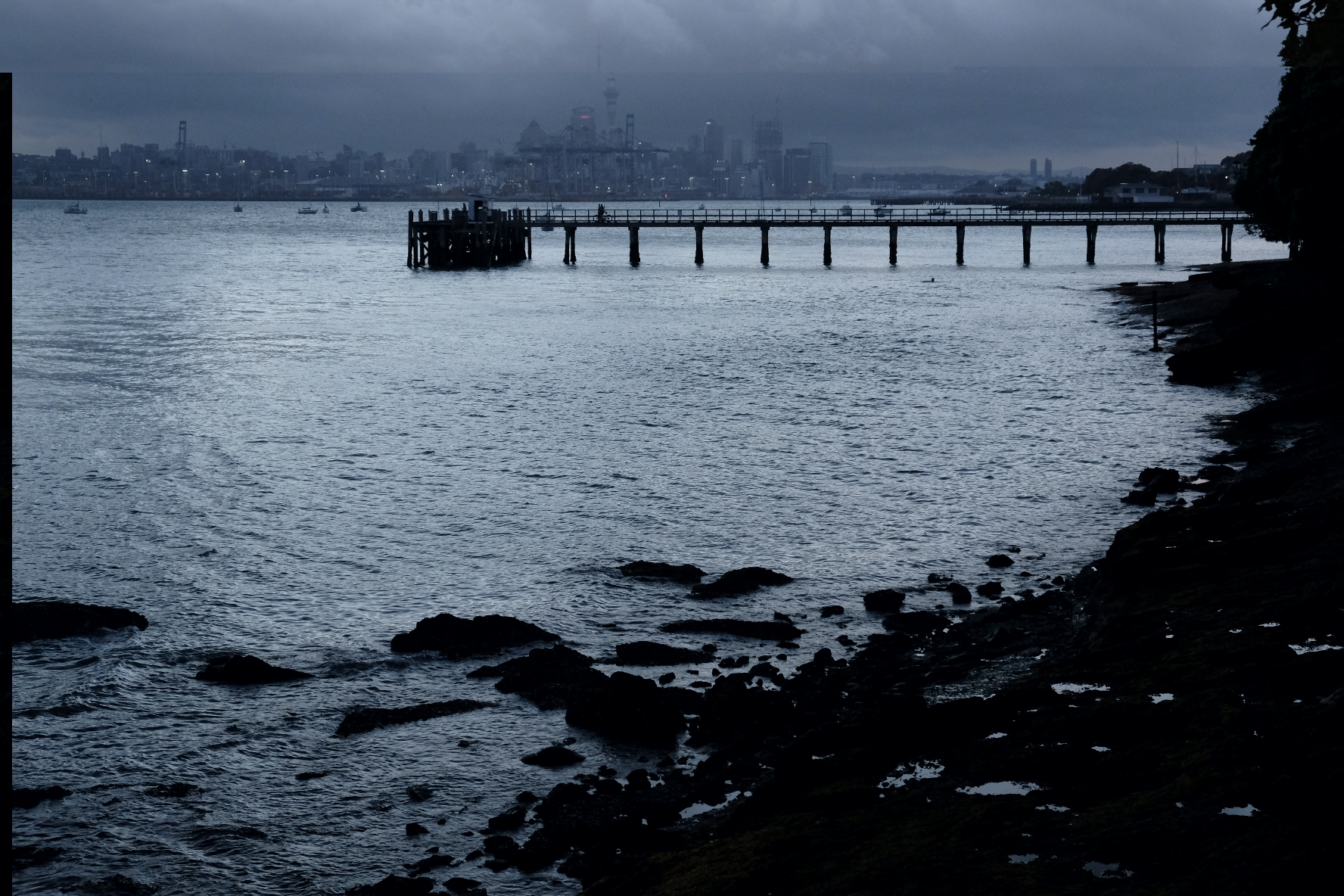
The next morning, nine of us set out for the Okura estuary, which can only be crossed at dead low tide. I’ve seen photos of people crossing it with water up to their nostrils, floating their packs across on their sleeping pads. No need, people! Just wait for low tide. It was about waist high for me (I’m 1.70 m), crossing between the third and fourth poles as described in the trailnotes. Jasper saw a giant skate (or ray) but I didn’t see it, sadly. Shoes on again, we tramped on. We very quickly realised we were entering the realm of Sunday strollers. There were dozens of people in (clean) sports clothes, running or cycling. Auckland must be close... The TA pretty much follows the east coast down from the suburbs into Auckland CBD. First parks appeared, then fancy houses. Courtney’s family showed up at Browns bay where we all went for delicious ice cream at the gloriously named Penguinos. Jasper and I were sorely tempted by the ten scoop sharing bowl (without any intentions of sharing, obviously). In the end we opted for a very reasonable two scoops each. We got takeaway Thai food for lunch and had to keep telling the staff that yes, we really did want to order from the dinner menu instead of the lunch menu with tiny portion sizes. Aaron’s foot was hurting again so Courtney’s dad drove him to the bus station, while Courtney’s mum walked a bit with us to Murrays bay. Here, we said goodbye to Courtney who was going to spend a few days with her family (but she’s fast, so she’ll catch up with us in no time). Together with Sarah and Iben, we continued down the shore. The weather was glorious and we took a large number of breaks, playing black stories along the way - we would say a brief weird statement like “a man orders albatross soup at a restaurant, eats one bite, and then kills himself”, then the others would have to figure out how/what/why asking only yes/no questions. An American tramper who caught up with us probably thought we were serial killers or something. We hiked a stretch with a Finnish guy as well. He’d been camping at the same spots as us for days but never spoke a lot, although he proved to be quite adept at figuring out albatross suicide stories. We took so many breaks (hello, ice cream truck!) that we were running a bit late and arrived at the ferry after sunset. After the ferry journey, we met up with Aaron again. He had already been to the hostel which was a good thing because we were getting a bit tired (it was a 35ish km day, after all) and he kept telling us we were almost there. The last steep climb of the day was up the sideroad to the hostel. Then showers, and beds! How on earth did we manage to reach Auckland - 600 km from Cape Reinga - in just 23 days?? Courtney would say it was the power of snacks. And I would agree with her.

No caption needed
Some more very important news: Philip is now on Instagram. You can follow his feathery adventures on Te Araroa. His username is philip.penguin
Fair warning, we’re still figuring out this whole Instagram thing. #allthehashtags